1/20


Non-buildable land for Sale
San Miguel de Salinas€ 585,000
Note
Listing updated on 08/04/2020
Description
This description has been translated automatically by Google Translate and may not be accurate
reference: E-02085
Non-development land for sale San Miguel de Salinas
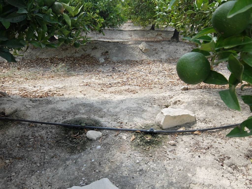
Agricultural farm with a 72 m2 implement house and 106,650 m2 of land planted with orange trees with drip irrigation with alternator with batteries and automatic fertilizer spreader.
Drinking water is 1 kilometer from the farm and electricity 500 meters. Completely fenced and with a raft of about 1,600 m2. The closest town is found about 3 kilometers Torremendo. Dirt road with good access.
San Miguel de Salinas is a municipality in the Valencian Community, Spain. Located in the south of the province of Alicante, in the region of Vega Baja del Segura. It has approximately 5811 inhabitants, 62.9% of whom are of foreign nationality.
Located between Torrevieja and Pilar de la Horadada, it is the highest town in the region. The 54 km² of the municipal area go down from the mountain in a path of ravines, ravines and hills to the plain, known as El Llano where the salt field is located, which is the cultivation area. Regional roads connect it with Orihuela, through Bigastro, Torrevieja and the towns of Vega del Segura.
From Alicante, this town is accessed through the A-7 and AP-7 to link with CV-940 and CV-941.
San Miguel limits with the municipalities of Orihuela —capital of the region—, which practically surrounds it except for the northeast that limits with Torrevieja and the north that does with Los Montesinos.
The main economic sector is agriculture, although industry and construction, driven by the development of the tourist sector thanks to its proximity to the coast, also pull the economy.
13 minutes by car from the Club Golf Villamartín golf course, 20 minutes from the 18-hole La Finca golf course par 72 in Algorfa, 20 minutes from the Marquesa de Rojales Golf course, 5 minutes from the motorway well in direction Murcia as Alicante and 40 minutes from Alicante Altet airport.

If you want to know more, you can talk to Román Perea.
Features
- Contract
- Sale
- Type
- Non-buildable land
- Surface
- 106,650 m²
- Difference in height
- Slight
Other features
- Electricity connection
- Water connection
Price information
- Price
- € 585,000
- Price per m²
- 5 €/m²
Energy efficiency
Emissions of CO₂
Not specified
Additional options

Román Perea


